MVTA System Map and Rider Guide
Minnesota Valley Transit Authority
Burnsville, MN
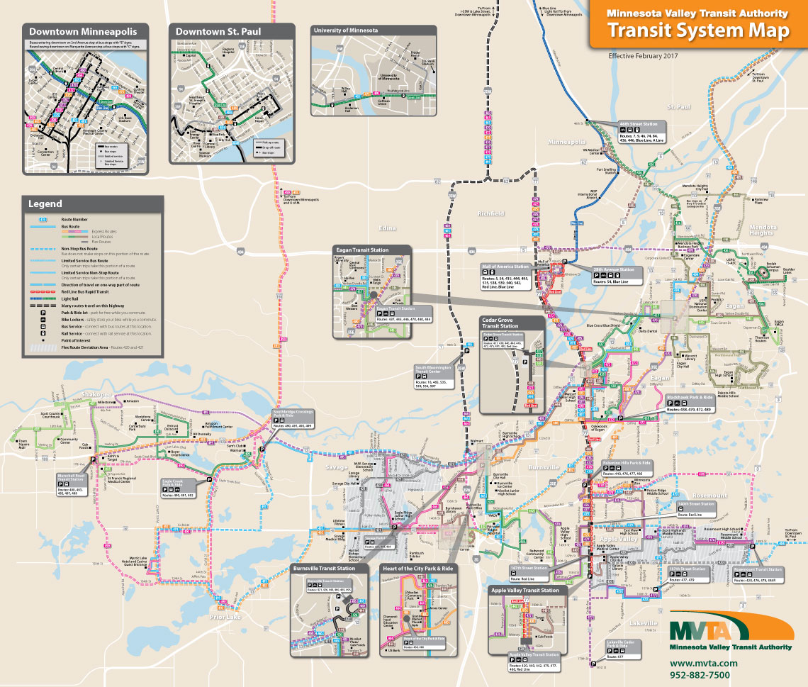
With about 25 bus routes providing local service in the Minnesota Valley area south of Minneapolis/St. Paul, service to the Mall of America, connecting service to the Hiawatha Light-Rail Line, and express commuter service to downtown Minneapolis and downtown St. Paul, the MVTA transit system map has to communicate a lot of information to a widely varying audience.
As the main informational piece, and likely the first piece a potential new rider would consult, it needs to clearly delineate the many routes and the type of service provided by those routes. This is done through a clear hierarchy of information, colored route lines, and a clear, easy-to-digest overall layout.
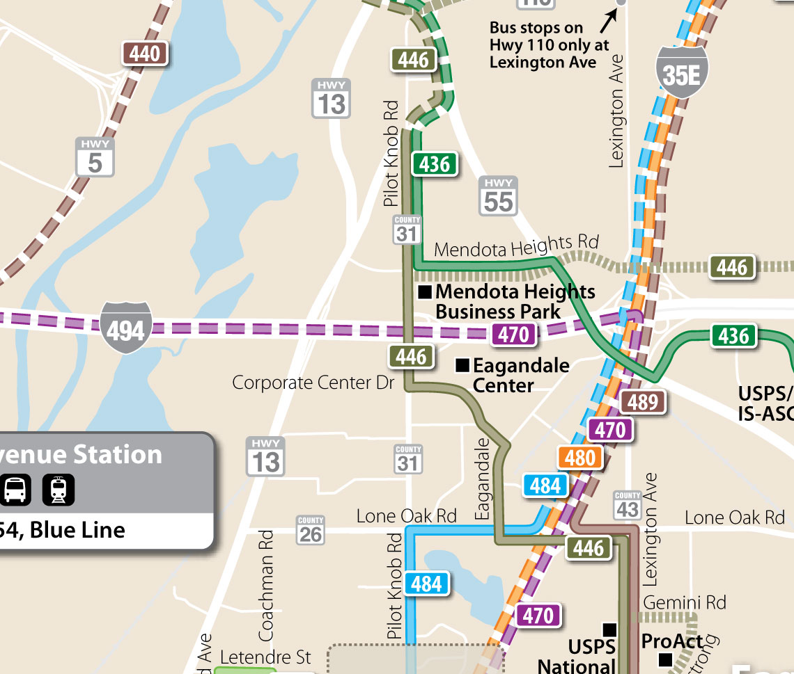
An interesting challenge when using color to distinguish routes is that you also must consider the color-blind user. In this case I designed a two-toned route line that help distinguish lines from each other where they touch or cross. While not foolproof, this greatly helps the color-blind user who might have a hard time distinguishing the colors.
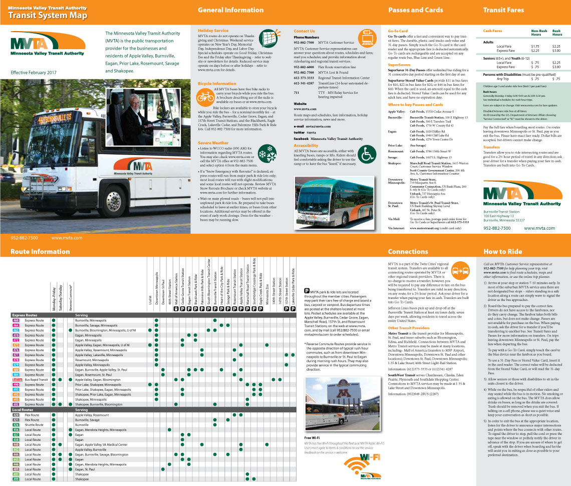
A chart on the side opposite the map provides detailed service information about each route to help a potential customer determine what routes will meet their needs, and information about how to ride the bus helps them get over the hurdle of making that first ride.
When a rider has determined which routes might serve their needs, a look at the route schedules for the particular route or routes will give them all the detail they need.